Talk Like a Local
Editor’s Note: Originally published November 27, 2017. Updated November 19, 2020.
Understatement: we live in a beautiful region.
Everett is a city with views of slate-grey water, hazy blue islands, and craggy mountain peaks.
I have been deeply moved in the northbound I-5 HOV lane by the sight of snowcapped Mt. Baker rising above the taillights of Boeing traffic.
I think a working knowledge of our bioregion is part of life here. What are we looking at every day? Do we see it and know what it is? The implications of this are pretty important. How do we relate to our environment?
Here is a guide to calling our surroundings by their names.
MOUNTAINS

Mt. Pilchuck is the conical mountain in the middle-left of this photo. It can easily be seen from downtown EVT.
Mt. Pilchuck is my favorite mountain, if only for it's proximity to E-town. I see it daily (weather permitting), rising above the houses on my street. It seems huge, but by mountain standards it's a little fella at just over 5,000 feet. It's a favorite for hikers who scale to the lookout on top. If you go be sure to pack for inclement weather no matter what season it is--- mountain microclimates are fickle and every year the news carries stories of hapless hikers stranded on Pilchuck.

Mt. Baker.
Mt. Baker, a mountain baby at 140,000 years of age, is covered in snow year-round. It's double the height of Pilchuck. And it's an active volcano. So look out.
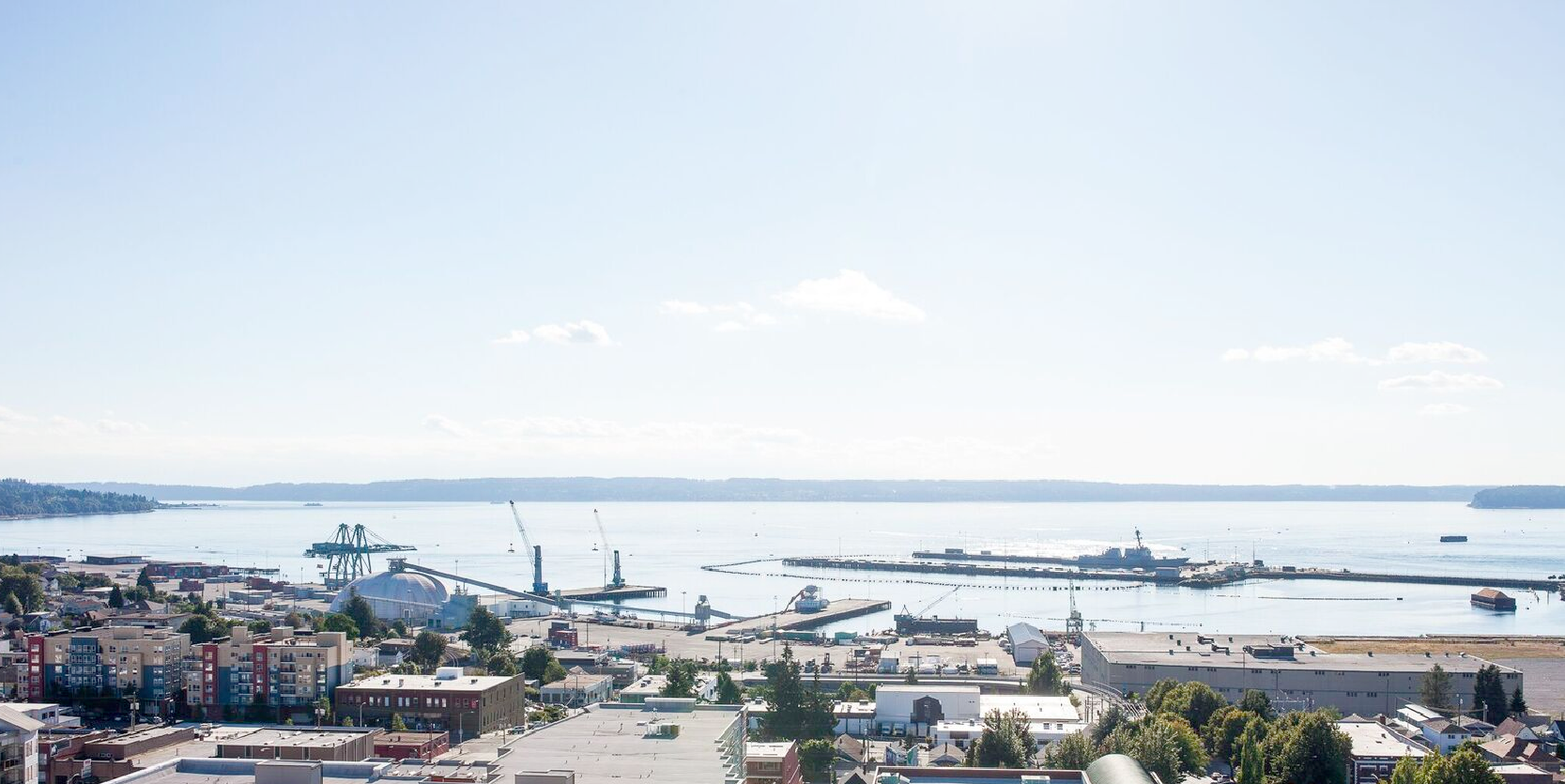
The best views of Baker are from the Port of Everett (breathtaking), Summit Park (breathtaking, plus car exhaust), and from HWY 99 (breathtaking plus neon and strip malls).

Three Fingers.
Three Fingers, north of Pilchuck, is notable among lesser peaks in the North Cascades for its size and distinctive shape. For a long time I called this mountain Three Sisters, but this is a mistake: Three Sisters is in Oregon.
Mt. Rainier. Don't be ridiculous, everyone knows this mountain. Haven't you ever drank cheap beer out of a tallboy?

The Olympics Mountains rise above Jetty Island, as viewed from the Everett Marina.
The Olympic Mountains are also visible to the west. They are the long line of white peaks that show up on clear days. A good place to view them is southbound from Marysville on SR 529, looking southwest over the Flats.
WATER

The Mukilteo ferry simultaneously crosses Possession Sound, Puget Sound, and the Salish Sea.
Puget Sound vs. Salish Sea vs. Possession Sound.
Okay, let's tease these out.
The waters directly to the west of Everett are known as Possession Sound. The sound was named by George Vancouver. This is not to be confused with Possession Bay (in the chilly South Sandwich islands of the Atlantic Ocean) or with Puget Sound (though Possession Sound is part of Puget Sound at large).
Also, Puget Sound, while the technically correct name for the giant body of water that extends down to Olympia, is somewhat of an antiquated and non-favorable term. Puget Sound is increasingly referred to as the Salish Sea.
The Salish Sea is a term used by, among other, the Canadian and US federal governments, to demarcate a network of regional waterways including the Straight of Juan de Fuca, the Georgian Straight, and Puget Sound.
The idea is to see the water off our coast as part of a large, unified, transnational ecosystem worth protecting. And to acknowledge the Salish people, who were fishing and navigating these bodies of water long before white settlement.
Will locals ever call Puget Sound "the Salish Sea"? Maybe not. But there it is and it pays to know its emerging nomenclature.
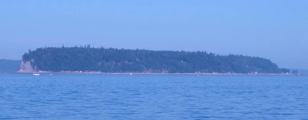
Hat Island aka Gedney Island aka that one island everyone takes photos of from Grand Avenue Park.
Gedney Island is also known as Hat Island. It's easily visible from Grand Avenue Park and Legion Memorial Park year-round. It's populated but mostly consists of vacation cabins and retirement homes. There's a ferry to/from Everett for Gedney residents, but the island isn't really open to public recreation.
Camano Island is just barely visible to the north from the Port of Everett, across the waters of Port Susan.
Whidbey Island is the big island directly across from Everett.
WHY YOU SHOULD CARE
I think the people behind the renaming of the Salish Sea are on to something important.
In an age of globalization does it still matter to have a regional consciousness? I can't answer that question for everybody.
I get something out of being able to identify rose hip bushes off of Marine View Drive, or wearing a classic PNW flannel shirt, or being moved by the surprising/not-surprising presence of Mt. Baker on a clear day. It makes me feel like I belong to a place, that I am a human experiencing and dressing for a land that's still awe-inspiring and rugged despite the roads and cities we've carved into it.
Talking like a local is important insofar that it makes me think like a local, which means a person from a particular place.
The Pacific Northwest is a beautiful place indeed.

Richard Porter writes for Live in Everett.